A Stamp Problem with a Money Problem
For most of the 19th century, France supplied its overseas possessions with a single general issue of stamps inscribed simply “Colonies.” The same stamp served in Martinique, Senegal, Cochin China and Tahiti. That was efficient, and it made money disappear.
The trouble was currency. France’s colonies used a patchwork of local money, and the value of a franc-denominated stamp varied depending on where it was bought. A shrewd buyer could purchase stamps in a colony where the local currency was weak, carry them to one where it was strong, and use or sell them at a profit. The colonial treasuries absorbed the loss. The fix was to put each colony’s name on its stamps, so a stamp bought in one place was good only there.
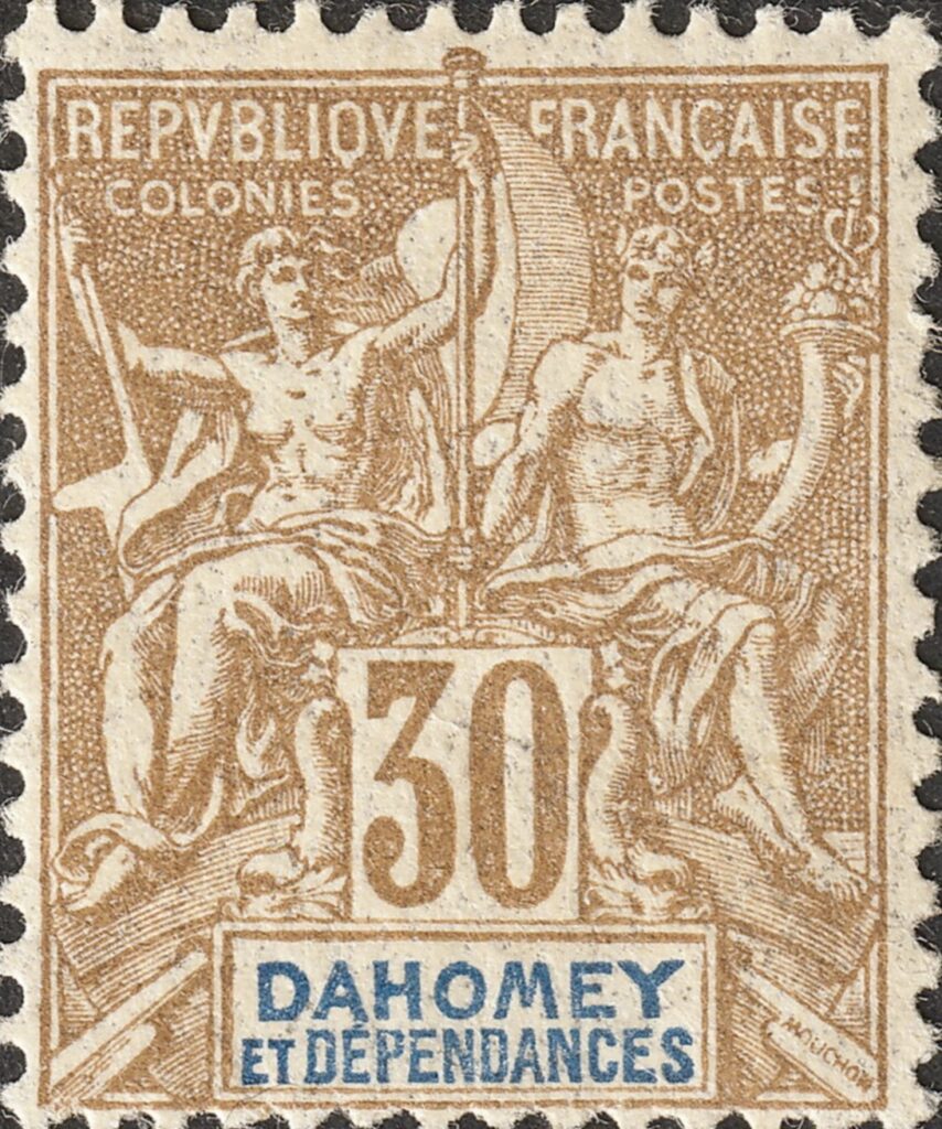
The answer came in 1892 with the Navigation and Commerce issue, the first French colonial series to carry individual territory names. Collectors also know it as the “Groupe” type, after the pair of figures at its center.
The Design
The stamp was designed by Louis-Eugène Mouchon, one of the busiest stamp engravers of the era, who would go on to design several issues for France itself. His picture is an allegory of the empire as Paris liked to see it. Two classical female figures sit together aboard a ship. One holds a rudder, representing Navigation; the other holds a cornucopia, representing Commerce. Above them run the words RÉPUBLIQUE FRANÇAISE and COLONIES POSTES.
At the bottom is the feature that made the series work: a small rectangular tablet holding the colony’s name. The stamps were printed in two passes. The main design and frame were printed first, and the name and value were added in a second pass, usually in red or blue. One master design could thus serve two dozen colonies, with only the tablet changing.
Philatelists call this a “key type.” Britain used the same approach for its colonies during this period, and the economics were the same. A single design meant a single set of master plates, a single printing process, and stamps that looked unmistakably official from the Caribbean to the South Pacific.
The two-pass method left its mark on the stamps. Now and then a sheet went through the second pass crooked, upside down or not at all. The resulting misplaced, inverted or missing name tablets are prized by specialists.
A Roll Call of the Empire
The value of the series for a historian is the list of names printed in those little tablets. Taken together, they form a snapshot of the French colonial empire at the height of the “Scramble for Africa.”
The old colonies are there: Guadeloupe, Martinique, French Guiana, Réunion, St. Pierre and Miquelon, and the French settlements in India. So are the Pacific holdings, New Caledonia and French Oceania (Tahiti and its neighbors). In Asia, the series covered French Indochina.
Africa is where the list grows crowded, because that is where the map was changing fastest. The West African names include Senegal, French Guinea, French Sudan, the Ivory Coast, Benin and, from 1899, Dahomey. Farther south came the French Congo and later Gabon. In the Indian Ocean the series reached Madagascar and a cluster of smaller places nearby.
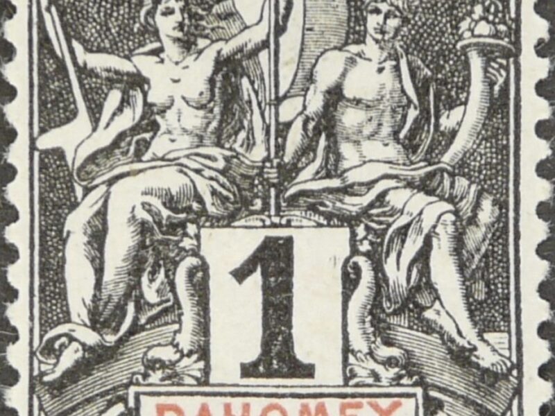
Several of these names carry the phrase et Dépendances. The black 1-centime stamp from Dahomey shown here is an example, but Dahomey was not alone. Guadeloupe, New Caledonia and Madagascar also had “and Dependencies” printed on their stamps. Each covered a main territory plus a scattering of smaller islands or protectorates governed with it.
The Ghost Colonies
Some of the names in the series belong to colonies that no longer exist, and some lasted only a few years. These are the most interesting stamps in the set.
Off Madagascar, France issued separate stamps for Diego-Suárez, Nossi-Bé and Sainte-Marie de Madagascar. Each was a small outpost that predated France’s full conquest of the main island. Once Madagascar itself was taken in the mid-1890s, these enclaves were absorbed, and their stamps went with them.
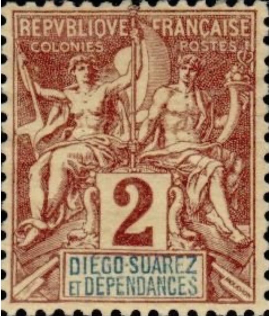
The Comoro Islands are an even more striking case. Each of the four main islands, Grande Comore, Anjouan, Mohéli and Mayotte, received its own Navigation and Commerce stamps. Four separate stamp-issuing entities for one small archipelago show how piecemeal French expansion had been. Each island had come under French control separately, and the stamps recorded that history.
On the Horn of Africa, Obock had its own stamps for the small port France held at the mouth of the Red Sea. It was the forerunner of French Somaliland, today’s Djibouti.
In West Africa, the tablets track the redrawing of the map almost year by year. Benin gave way to Dahomey in 1899. French Sudan was broken up in 1899 and its territory divided among its neighbors. In 1903 a new name appeared, Senegambia and Niger, which itself lasted only a few years before another reorganization replaced it. A collector who lays these stamps out in order is reading a running record of colonial administration.
Retirement and Reuse
The Navigation and Commerce design did not last. Within a decade or so of its debut, France began giving its colonies individual pictorial stamps showing local scenes, people, plants and colonial heroes. These replaced the one-size-fits-all allegory. The timing varied, but by the early 20th century the old key type was on its way out nearly everywhere.
Large stocks remained. Rather than destroy them, colonial post offices overprinted and surcharged the leftover stamps with new values and kept selling them. Many colonies have pages of these provisional surcharges, sometimes printed locally and sometimes in Paris, which keeps specialists busy to this day.
The Forger’s Favorite
The series had one more chapter. Between 1917 and 1923, the forger Charles Hirschburger, who continued the business of the notorious François Fournier, produced copies of the Navigation and Commerce stamps in most denominations. He printed them in sheets of 30, each stamp with a different colony name in its tablet. The key-type format that served the French post office so well also served him: one forged design, many colonies.
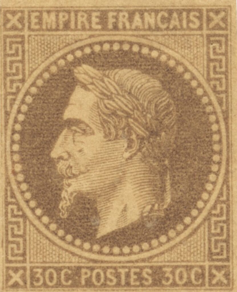
These forgeries survive in large numbers and still turn up in old collections. The easiest giveaway is the perforation. Genuine stamps measure 14 by 13½, while the forgeries are perforated the other way, 13½ by 14.
A Small Picture of a Large Ambition
The Navigation and Commerce stamps were meant to solve an accounting problem, and they did. In doing so they left something more lasting: a set of small, uniform images that together map an empire spread across three oceans. The two figures on the ship never changed. The names beneath them did, often, and those changes tell the story.